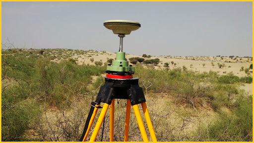
Differential GPS (DGPS) surveying is a technique used to improve the accuracy of Global Positioning System (GPS) measurements. In DGPS, a network of fixed ground-based reference stations broadcast the difference between the positions indicated by the satellite systems and the known fixed positions. These corrections are then received by a GPS receiver, enabling more accurate position determination.
DGPS improves positional accuracy by correcting GPS signals for errors caused by factors like atmospheric conditions, satellite orbits, and clock discrepancies. It is commonly used in applications where high precision is crucial, such as in surveying, navigation, and geodetic measurements. With DGPS, accuracy can often be improved to within a few centimeters.invaluable for presentations, planning, and design purposes across various industries, including architecture, urban planning, and engineering. With our 3D modeling services, you can effectively visualize your projects, facilitating informed decision-making and collaboration among stakeholders. Elevate your project's presentation and impact with our expert modeling solutions.