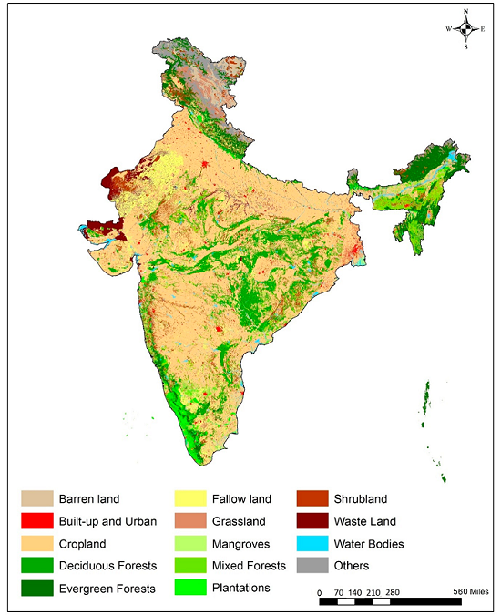
Land use land cover maps
Our Land Use Land Cover maps provide essential insights into the distribution and extent of various land uses and vegetation types. Utilizing advanced remote sensing technologies, we collect and analyze geospatial data to deliver high-resolution maps that help clients understand land use patterns, assess environmental impacts, and support urban planning. Whether you are in agriculture, forestry, or urban development, our comprehensive maps empower you to make informed decisions that drive sustainable growth and resource management.
Let's talk
We would love to hear from you!